Wikipedia schemes
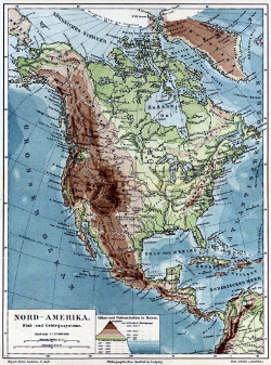
The Meyer map of North America
Elevation schemes taken from scans of maps of North America in old encyclopedias; the Meyers Konversationslexikon (1885–1890) and Nordisk familjebok (1876–1957). The fading of ink, the browning of the paper and inaccuracies in the scanning process will mean that these schemes are much muddier than the (unknown) authors intended.

meyers

nordisk-familjebok
Public domain due to age: See details and XML record.