Technology

page logo

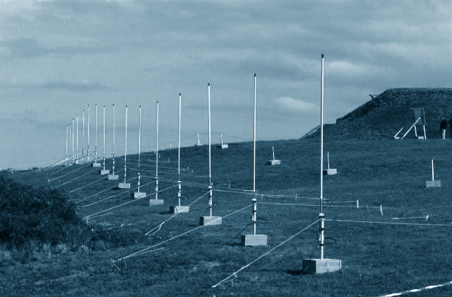
High Frequency (HF) radars located on the coast or on an offshore platform measure radio waves backscattered from waves on the ocean surface out to around 200km from the radar.

Seaview Realtime Software takes in the Doppler spectra from the radar and provides metocean data in real time, locally or online.

wera radars
WERA radars

Research

The Seaview Realtime System is backed up by years of experimentation and research.

Publications

Lucy R Wyatt

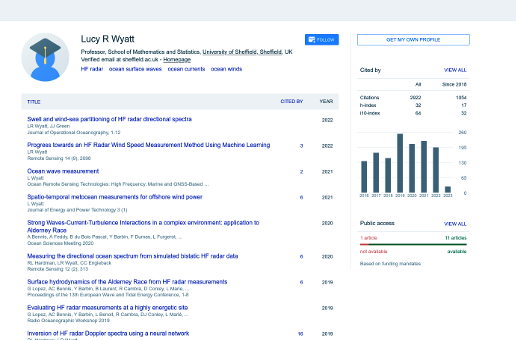
A list of papers authored by Lucy R Wyatt is available from her Google Scholar page.

Google Scholar
screenshot of lucy's scholar page

Relevant Papers

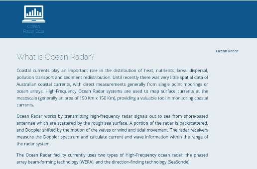
A further list of relevant papers can be found at Integrated Marine Observing System (IMOS) website in the Papers section.

IMOS
screenshot imos ocean data page

HF Radar

Further information and publications relating to HF Radar can be found on the CODAR Ocean Sensors website.

CODAR
codar logo

Radar

HF Radar

The big advantage of HF radar over other coastal metocean measurement systems is the ability to map parameters over a wide area. HF radar signals have to be processed to separate them into contributions from different ranges and from different directions relative to each of the radar stations.

Range measurement

Range measurement is achieved using time or frequency differences, depending on the radar signal modulation, between the transmitted and received signal. For FM(I)CW (frequency modulated (interrupted) continuous wave) modulation this is usually achieved using an FFT. Range resolution depends on the bandwidth of the transmitted signal for FM or pulsed systems.

Direction measurement

The starting point for metocean measurement is a Doppler (power) spectrum of signal at each range and direction usually obtained with an FFT.

Surface current measurement

Surface current measurements are obtained by measuring the Doppler frequency of the peaks in the backscattered power spectrum. The measurement is actually that of the speed of ocean waves of half the radio wavelength travelling towards and away from the radar. To first order, this speed is made up of the intrinsic wave speed (determined from the well-known dispersion relationship for ocean surface waves) plus the component of surface current in the direction of wave propagation.

HF Radar Types

Beam forming, phased array radar systems such as WERA, Pisces, Generic-HFDR or OSCR are used to provide data for Seaview Realtime Software.

Compact antenna systems that use direction finding techniques are not suitable for mapping waves and our software cannot be used with such radars. They can provide limited information on waves close to the radar sites.

For customers that do not have their own radar systems Seaview partners with Helzel GmbH and Neptune Radar Ltd and OceanPhysics to provide the best solution for their requirements.

Radar Accuracy

Current measurements using HF radar are well established and proven both in research and the operational oceanography industry.

However the accuracy of wave measurements is still questioned in some quarters. Seaview Realtime Software has been used with a variety of HF phased array radars, Pisces, WERA, Generic-HFDR and OSCR in various locations worldwide and the data has been compared to local Met Office models and wave buoy data with excellent results.

For more information on this discussion see HF Radar for Real-time Current, Wave and Wind Monitoring from Hydro International April 2005.

For more recent validations see Lucy Wyatt’s Google Scholar page.

Data collection

Radar data collection period is dependant on:

  • the beam-forming methods of the radar
  • the required averaging period for wave measurement

Measurement data updates

Current
typically 10 minutes
Wave
20 minutes to 1 hour

Factors that can impact data availability

Maximum range of measurement depends on:

  • radio wave length
  • metocean parameter being measured
    for example:
    • low radio frequencies can provide current measurements to 200 km
    • high radio frequencies can provide wave measurements to 20 km
  • radio interference environment
  • sea-state

Software

Converting signal to wave data

The main contribution to the signal at the radar receiver is Bragg scatter from ocean waves with half the radio wavelength. At HF (3-30 MHz) these waves are nearly always locally wind-generated.

The Amplitude of the backscattered signal is related to wave height and direction.

The Doppler shifted frequencies in the signal are related to surface current and wave propagation speeds.

Seaview Realtime Software obtains metocean measurements from the signal using methods for inverting the equation that describes the relationship between HF radar backscatter and the ocean wave directional spectrum developed at the University of Sheffield.

It provides spatial and temporal scale measurements of:

  • current
  • waves
  • winds

Data Processing

Metocean data is calculated at multiple grid points across the coverage area for instance:

  • 300 high quality data points
  • across an area of 500 to 20 km2.

The full directional spectrum for the waves is calculated at each point with sufficient signal, which allows variation in the wave field to be accurately captured.

With present technology calculations take around 0.16 sec per data point, so typically the entire area may be updated in less than one minute after the radar data have been collected.

The data are processed on the installed Seaview Realtime Server to produce .sea files.

Currents and wind direction

Measurements are taken from the two main peaks in the radar power spectrum for each point across the radar coverage area. Surface current measurements from frequencies, wind direction measurements from amplitude.

Waves

Seaview Realtime Software calculates wave data by numerical inversion of an equation relating the radar power spectrum (the measured quantity) to the ocean wave directional spectrum (the solution of this inversion).

This is based on the theory developed by Barrick in the 1970s which provides a good description of the backscattered signal over the full range of HF radar frequencies in low sea states and for low HF frequencies in high sea states.
Operating Systems

The software is designed to be portable across POSIX.1 conforming operating systems.

It has been sucessfully run on Solaris-Sparc and Linux-x86 systems.

Software platforms

Server and real-time processing
Debian Linux
Off-line processing
Debian / Ubuntu / Redhat / openSUSE Linux
Solaris / General UNIX

Seaview Sensing Video